Cheoah Ranger District Adventures
The Cheoah Ranger District offers a rugged and diverse landscape amidst the Nantahala National Forest, famous for its challenging trails and breathtaking vistas.
Popular Activities
Discover the Untamed Trails of Cheoah Ranger District, North Carolina: An Adventurer’s Guide
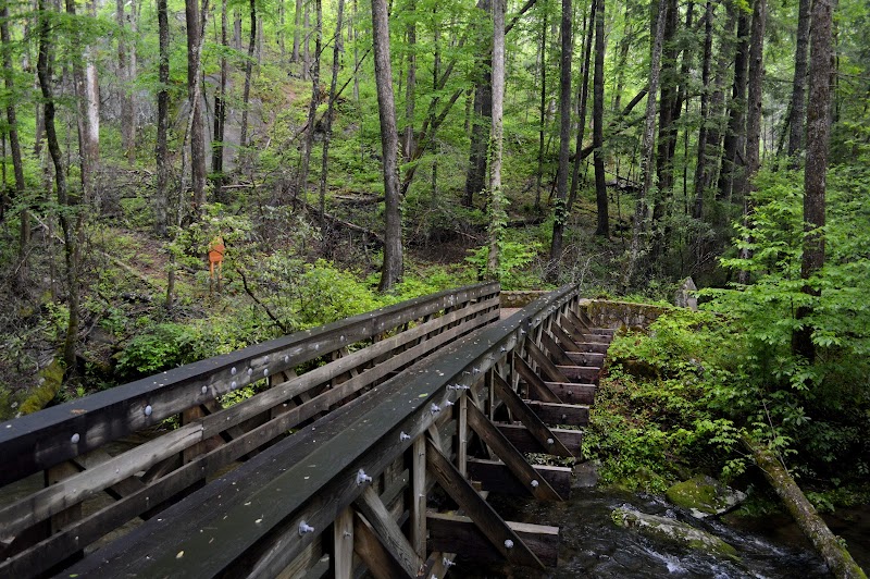
In the heart of North Carolina's Smoky Mountains lies an explorer's paradise—the Cheoah Ranger District. Each step on these rugged trails holds the promise of both challenge and awe, inviting hikers to uncover treasures hidden beneath the forest canopy. The air here hums with the whispers of ancient trees and the lively chatter of mountain streams. As you thread through the landscape, moss-draped stones and gnarled roots bring the forest floor to life, each irregular shape nudging you toward discovery on this domain of adventure.
Start your journey at the Joyce Kilmer Memorial Forest, where towering tulip poplars and hemlock demand reverence. These giants, some over 400 years old, form a verdant archway, inviting you deeper into the wilderness. The trail unfurls around them, easy underfoot yet steeped in history. Here, it's not just a walk; it's a dialogue with time itself. At only 2 miles, this loop is perfect for families and novice hikers, yet its impact is mighty, offering a glimpse into primordial beauty that once spread across the continent.
For the more seasoned explorer, Hangover Lead offers a vigorous climb 10 miles round-trip, rewarding every bead of sweat with breathtaking views. Upward through a riot of rhododendron and mountain laurel, the trail ascends, revealing a panoramic vista at the peak. Look out over a sea of mountains, their blue-green peaks fading into the horizon—each seemingly daring you to explore just a little further. Balance is key here; sturdy hiking boots will ensure confidence on the uneven, rocky paths that occasionally test even the most prepared adventurer.
Meanwhile, the footpaths of Joyce Kilmer-Slickrock Wilderness promise unbridled exploration for those who yearn to stray from well-worn trails. Before setting out, embrace the practicality of preparation: pack enough water and energy-rich snacks, and consider a map and compass for paths less trodden. This wilderness, a canvas of rich biodiversity, hosts everything from the chirp of crickets at midday to the hoot of owls as twilight descends. Every sound weaves a part of your journey, making each pause as rewarding as the steps between.
For climbers, the towering rocks along these trails provide numerous opportunities. The ancient stone, weathered yet resolute, is more than an obstacle—it's an invitation. The rough quartzite sings under your fingertips as you ascend, the sunlight dancing in patches through the leaves. Ensure your gear is tailored to the challenge: a helmet for safety, climbing shoes for grip, and a chalk bag for those who pursue the vertical path. Remember, it's as much about the climb as it is about the moment atop when earth gives way to sky.
For those planning their hike, timing is everything. Spring and early fall are the prime seasons, offering cooler temperatures and an explosion of color—fiery reds and ambers that set the hillsides ablaze. Summer attracts the adventurous of spirit, with warm breezes that dance through the leaves and the trails awash with the scent of sun-warmed earth. However, hiking in the early mornings or late afternoons will help evade the heat and bask in a softer, golden light.
So, whether you're drawn to the quiet contemplation of a shaded trail or the exhilarating rush of the climb, Cheoah Ranger District stands ready to fulfill the call of your adventurous spirit. Each trail here invites, challenges, and ultimately rewards, spinning a tale of distant echoes woven into the wild pulse of the natural world. Come prepared, come with a purpose, and leave with a story that's uniquely yours.
Plan Your Visit
Everything you need to know to prepare for an unforgettable trip to Cheoah Ranger District.
Entrance Requirements
No permits needed for entry, though fees may apply for certain activities like camping.
Best Time to Visit
Best visited in spring and fall for mild weather and peak natural beauty.
Visitor Information
Cheoah Ranger Station is the primary source for information and permits.
Getting There
Accessible via U.S. Highway 129; some roads may be seasonal due to weather conditions.
Weather & Climate
The region experiences humid summers with temperatures ranging from 60°F to 85°F and cold winters with temperatures between 20°F and 50°F. Rainfall is abundant, particularly from March to June.
Conservation Efforts
Ongoing efforts to manage invasive species and protect endangered flora and fauna are critical. Visitors are encouraged to practice Leave No Trace principles to minimize impact.
Camping in Cheoah Ranger District
Find the perfect spot to stay overnight and immerse yourself in the details.
Cheoah Point Campground
Located by Santeetlah Lake with facilities and beautiful water views.
Rattler Ford Group Campground
Suitable for groups, offering more privacy and direct access to trails.
Top Trails
Joyce Kilmer Trail
Features towering ancient trees and an interpretive loop through a stunning, verdant forest.
Hangover Lead Trail
Provides challenging terrain with impressive views from Hangover Rock.
Appalachian Trail Section
A prime section of the Appalachian Trail featuring elevation changes and panoramic vistas.
Yellow Creek Falls Trail
Leads to a picturesque waterfall and offers a serene environment.
Trailblazer Tips
Check trail conditions before visiting, as some paths may be prone to washouts.
Fall offers spectacular foliage, but prepare for cooler temperatures.
Free access, but certain areas might require a camping permit.
Bring a map and compass; GPS can be unreliable in dense forest areas.